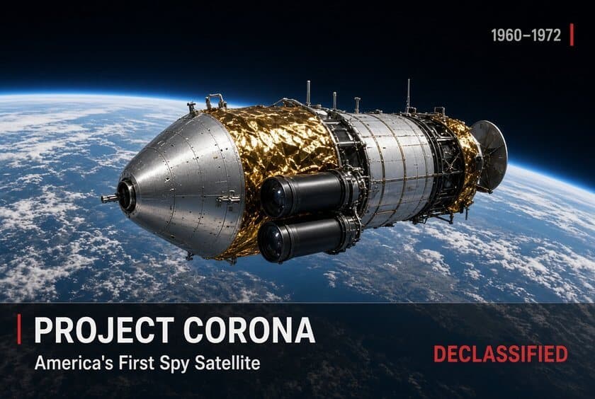
CORONA was the first United States photographic reconnaissance satellite program. It was developed in the late 1950s by the Central Intelligence Agency, the U.S. Air Force and private industry, and it flew from 1960 to 1972 under the public cover name DISCOVERER (CIA, “CORONA Declassified”).
Its cameras photographed the Soviet Union, China and other areas, and the film was returned to Earth in capsules recovered in mid-air. The program remained classified until February 1995, when Executive Order 12951 released its imagery to the public.
Background
In the late 1950s, U.S. intelligence estimates of Soviet strategic forces were uncertain. A classified 1973 CIA history of the program, written by Kenneth E. Greer and published in a supplement to Studies in Intelligence, records that planners did not know how many long-range bombers the Soviet Union had or whether it had shifted from bombers to missiles (Greer, 1973, p. 20).
By 1959 the “missile gap” controversy was under way, and intelligence agencies held widely differing views on Soviet missile strength (Greer, p. 20). The U-2 aircraft had improved U.S. knowledge but could not provide area coverage, and it was judged an increasing political liability (Greer, p. 20).
President Dwight D. Eisenhower formally endorsed CORONA in February 1958 (CIA, “CORONA Declassified”). The program was publicly presented as the Air Force’s DISCOVERER series of research satellites (CIA, “CORONA Declassified”).
Early failures
The first missions failed repeatedly. After a series of failures, a standdown was in effect from November 20, 1959 to February 4, 1960 for intensive work on their causes (Greer, p. 20).
The most persistent problem was bringing the film capsule back on a trajectory that ended in the recovery zone; according to Greer, a one-second error in the timing of its ejection could shift the landing point by about five miles (Greer, p. 20).
Of the first 30 missions from 1960 through 1962, 12 were considered productive (Ruffner, 1995, Part 1 introduction).
First recovery: DISCOVERER XIV, August 1960
In May 1960 the Soviet Union shot down a U-2 and captured its CIA pilot, Francis Gary Powers (Ruffner, preface). Days before the first film recovery, the DISCOVERER XIII capsule, which carried no camera, was retrieved from the Pacific Ocean by ship after the recovery aircraft missed it (Greer, p. 24). The New York Times reported its return on August 12, 1960 (Ruffner, Part 1 introduction).
DISCOVERER XIV was launched on August 18, 1960. On August 19, a C-119 aircraft flown by Air Force Capt. Harold E. Mitchell caught its descending capsule at 8,500 feet on the third pass over the parachute. The capsule weighed 84 pounds at recovery (Greer, p. 24; Ruffner, preface).
It was the first film recovered from a satellite. The photographs were of lower resolution than U-2 imagery, but the single mission covered more of the Soviet Union than all previous U-2 missions combined, including areas the U-2 had never reached (Greer, p. 24; Ruffner, preface).
The film carried diagonal density bars, some caused by an electrostatic discharge known as corona. Greer noted that this showed “great insight” by the security officer who had named the program (Greer, p. 24).
Camera versions
The imagery was handled in a security control system called KEYHOLE, and successive camera systems were designated KH-1 through KH-4B (Ruffner, preface):
- KH-1 (1959–1960): nominal ground resolution of 40 feet.
- KH-2 and KH-3: about 10 feet.
- KH-4 (from 1962; 26 launched): the MURAL camera, the first to produce stereoscopic imagery by photographing each target from two angles.
- KH-4A (1964–1969; 52 launched): the J-1 camera.
- KH-4B (1967–1972; 17 launched): the J-3 camera, with a resolution of about 5 feet.
Two related systems had less success. ARGON flew mapping missions in the early 1960s, and LANYARD (KH-6) was begun and abandoned in 1963 (Ruffner, preface).
What the imagery showed
According to an intelligence community study quoted in the CIA volume, CORONA’s first major accomplishment was imaging all Soviet medium-range, intermediate-range and intercontinental ballistic missile launch complexes (Ruffner, preface).
CORONA imagery identified the Plesetsk missile test range north of Moscow and gave the first view of Severodvinsk, the main Soviet construction site for ballistic-missile submarines. It first showed construction of the GALOSH antiballistic missile sites around Moscow, and it located Soviet surface-to-air missile batteries used in planning U.S. bomber routes (Ruffner, preface). The imagery also became almost the sole source of U.S. military mapping data (Ruffner, preface).
Greer wrote that satellite intelligence helped the United States avoid the kind of floundering that had occurred during the “missile gap” period (Greer, p. 38). He also recorded a non-Soviet use: in 1970, CORONA Mission 1111 photographed the Middle East to provide a baseline for checking compliance with the Israeli-Egyptian cease-fire along the Suez Canal (Greer, p. 38).
End of the program
The 145th and final CORONA launch took place on May 25, 1972, and the final recovery on May 31, 1972. It was the program’s 165th capsule recovery, more than all other U.S. recovery programs combined (Greer, p. 38). Greer put the program’s total coverage at approximately 750 million square nautical miles of the Earth’s surface (Greer, p. 38). The total cost figure in the same passage remains redacted (Greer, p. 38).
Declassification
The U.S. government did not acknowledge that it used satellites for intelligence until 1978, when President Jimmy Carter stated that satellites were used to verify arms control treaties (Ruffner, preface). In 1992, Director of Central Intelligence Robert Gates formed an Environmental Task Force.
At the urging of then-Senator Al Gore, the CIA also formed a Classification Review Task Force to examine declassifying imagery from obsolete broad-area satellite systems. Both panels concluded that releasing the imagery posed no threat to national security, and Director of Central Intelligence R. James Woolsey approved their recommendations (Ruffner, preface).
President Bill Clinton signed Executive Order 12951 on February 22, 1995. Section 1 ordered imagery from the CORONA, ARGON and LANYARD missions declassified and transferred to the National Archives within 18 months, with a copy to the U.S. Geological Survey.
Section 2 directed a review of imagery from other obsolete broad-area film-return systems within five years (E.O. 12951). Vice President Gore announced the order at CIA Headquarters on February 24, 1995 (CIA, “CORONA Declassified”).
The CIA put the release at more than 800,000 images (Ruffner, preface). The USGS, which holds the digital collection, describes it as more than 860,000 images collected from 1960 to 1972 across the three systems (USGS).
Some 60,000 high-resolution scans can be downloaded free through the USGS EarthExplorer system; the remainder are available by order (USGS). The CIA History Staff published a selection of the program’s declassified documents in 1995 as CORONA: America’s First Satellite Program, the fourth volume in its Cold War Records Series (Ruffner, 1995).
Sources
- Kevin C. Ruffner, ed., CORONA: America’s First Satellite Program, CIA History Staff, Center for the Study of Intelligence, 1995 (PDF). Cited as “Ruffner.”
- Kenneth E. Greer, “CORONA,” Studies in Intelligence, classified supplement, Spring 1973; reprinted as Document 1 in Ruffner (1995). Cited as “Greer” with printed page numbers.
- CIA Center for the Study of Intelligence — CORONA: America’s First Satellite Program (catalog page)
- CIA — “CORONA Declassified”
- Executive Order 12951, “Release of Imagery Acquired by Space-Based National Intelligence Reconnaissance Systems,” February 22, 1995 (American Presidency Project)
- U.S. Geological Survey — USGS EROS Archive, Declassified Satellite Imagery – 1